汽车工程 ›› 2022, Vol. 44 ›› Issue (2): 199-207.doi: 10.19562/j.chinasae.qcgc.2022.02.006

所属专题: 智能网联汽车技术专题-感知&HMI&测评2022年

• • 上一篇    下一篇

基于图优化的室外无人车多图层地图构建

牛国臣(),冯宁,王瑜   

  1. 中国民航大学机器人研究所,天津 300300
  • 收稿日期:2021-09-06 修回日期:2021-11-04 出版日期:2022-02-25 发布日期:2022-02-24
  • 通讯作者: 牛国臣 E-mail:niu_guochen@139.com
  • 基金资助:
    天津市科技计划项目(17ZXHLGX00120)

Multi-layer Map Construction for Outdoor Unmanned Vehicles Based On Graph Optimization

Guochen Niu(),Ning Feng,Yu Wang   

  1. Robotics Institute,Civil Aviation University of China,Tianjin 300300
  • Received:2021-09-06 Revised:2021-11-04 Online:2022-02-25 Published:2022-02-24
  • Contact: Guochen Niu E-mail:niu_guochen@139.com

摘要:

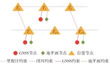
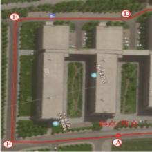
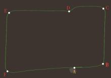
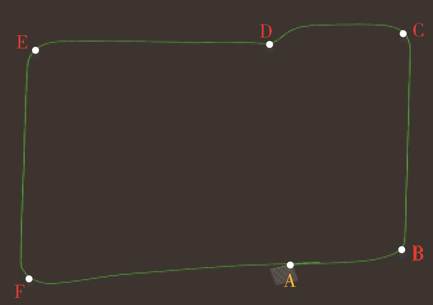
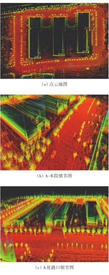
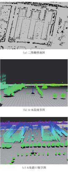
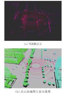
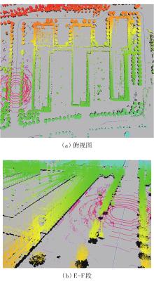
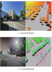
地图构建是实现无人驾驶的重要前提,针对传统单一地图无法准确实现无人车自主导航的问题,本文中提出一种低成本的室外多图层地图,分轨迹层-静态层-动态层。轨迹层为GNSS拓扑地图,静态层为基于图优化构建的点云-栅格地图,动态层为实时激光点云信息。首先轨迹层的绝对位置信息用于实现无人车的全局路径规划,然后基于动态层实时信息与静态层的点云地图做匹配,完成无人车实时高精度定位,最后对动态层进行障碍物检测,通过将实时障碍物信息同静态层的栅格地图结合,为无人车避障和局部路径规划提供环境信息。在实际环境下对提出的地图进行了评估,验证了该地图的可用性。

关键词: 地图构建, 多图层, 定位, 导航

Abstract:

Map construction is the foundation of autonomous driving. For the problem that the traditional single map cannot realize the autonomous navigation of unmanned vehicles accurately, a low-cost outdoor multi-layer map is proposed in this paper, which consists of the track layer, static layer and dynamic layer. The track layer is a GNSS topological map while the static layer is a point cloud-grid map based on graph optimization and the dynamic layer is real-time laser point cloud information. Firstly, the absolute position information contained in the track layer is used for global path planning of the unmanned vehicle. Secondly, based on the real-time information of the dynamic layer and the point cloud map of the static layer, the unmanned vehicle is positioned in real-time with high precision. Finally, obstacle detection is implemented on the dynamic layer and the real-time obstacle information is combined with the grid map of the static layer to provide information for obstacle avoidance and local path planning of unmanned vehicles. The proposed map is evaluated in the actual environment and the applicability is verified.

Key words: map construction, multi-layer, positioning, navigation